A high performance platform for organisations that need to fuse real-time data, maintain operational situational awareness and make fast, spatially informed decisions at enterprise scale. Veris provides Alto licensing, implementation, support and training.
Product overview
Real-time operational intelligence for critical environments
Octave Alto is designed for operational environments where the currency and clarity of spatial information are mission-critical. It brings together live sensor feeds, enterprise data sources, spatial layers and complex 2D/3D/4D content into a single connected environment - enabling operational teams to see clearly, act quickly and share awareness across the organisation.
High-fidelity 2D, 3D and 4D visualisation
Render large, complex spatial datasets with smooth, responsive performance. Detailed maps, 3D models and time-based visualisations help operational teams understand context, change and relationships instantly.
Real-time data fusion and live feeds
Connect to live data sources - sensors, IoT devices, enterprise systems, external feeds, and consume them directly into Alto's visualisation and analytics environment.
Powerful geospatial analytics
Run spatial queries, calculations and predictive models directly on fused data. Detect patterns, trends and anomalies quickly. Compare scenarios against historical or live data.
Secure enterprise-scale deployment
Alto supports robust authentication, granular access control and flexible deployment - on premises, cloud or hybrid. Scales from small teams to enterprise-wide operational deployments.
Common operating picture
Bring together data, visuals and context into one shared operational view. Teams align decisions, share insights and maintain consistent situational awareness in real time.
Veris support for Alto
- License procurement and guidance
- System architecture and integration advisory
- Data source and feed configuration
- Deployment planning (on-prem / cloud)
- Operational team training
- Technical support and troubleshooting
- Upgrade planning from Luciad
- Enterprise enablement programmes
Using legacy products already?
Octave Alto is the successor to Apollo, M.App Enterprise, Smart Sites and the Luciad product suite, including LuciadLightspeed. Veris supports organisations transitioning from existing Luciad and other product deployments to Octave Alto.
Octave Alto in practice
CRITICAL INFRASTRUCTURE

Infrastructure monitoring and operational awareness
Fuse sensor, IoT and SCADA data with spatial context to monitor distributed infrastructure assets in real time. Alto provides a clear operational picture for condition monitoring, anomaly detection and incident response.
TRANSPORT

Transport network operations and management
Monitor real-time vehicle positions, sensor feeds and network conditions in a unified spatial environment. Alto supports traffic management, incident response and operational planning for complex transport networks.
DEFENCE-ADJACENT
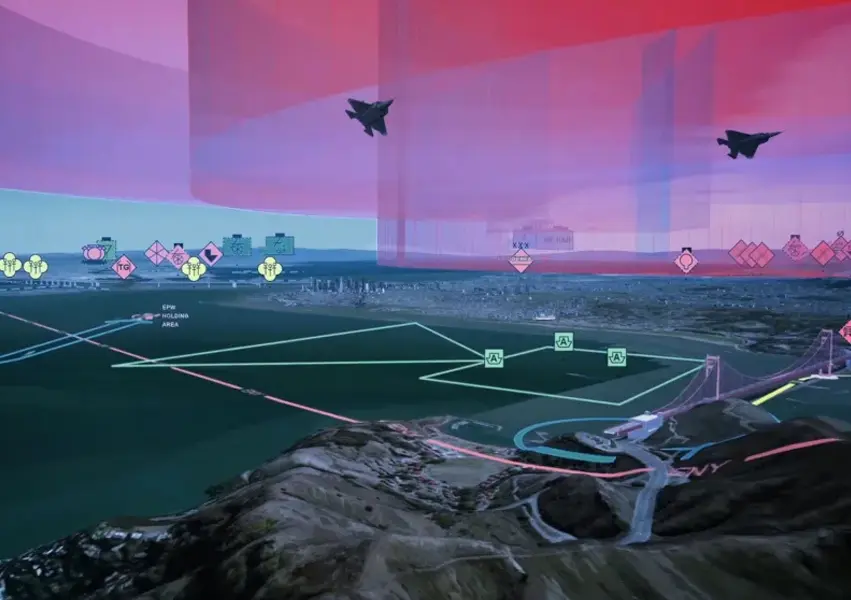
Situational awareness for operational demand
Integrate multiple live data streams and spatial intelligence sources into a high performance 3D operational environment. Designed to support fast, coordinated decision-making in complex operational contexts.
EMERGENCY RESPONSE
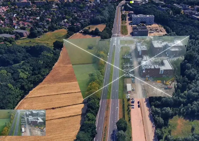
Emergency operations and coordinated response
Maintain a live common operating picture across agencies during emergency events. Real-time data feeds, 3D terrain and resource tracking support coordinated response and command decision-making.
Talk to Veris about Octave Alto
Enquire about Alto licensing, book a demo, or ask about implementation support and training for your operational team.