From potholes to priorities: better road decisions start with better data
Potholes are often where the conversation about road condition begins. For drivers, they're an immediate frustration. For councils and road authorities, they sit within a much larger challenge: understanding the condition of an entire network and deciding where maintenance investment will have the greatest impact.
As road funding becomes part of the election conversation, attention naturally turns to repairs. Delivering those repairs effectively requires a clear picture of what is happening on the road, where deterioration is occurring and, in some cases, what is happening beneath the surface.
Veris connects practical road data capture with analysis and accessible digital tools, helping road managers turn observations into evidence for maintenance planning.
Start with a detailed picture of the road
A maintenance program needs information that extends beyond individual reported defects. Teams need to understand the location and extent of deterioration across the network, alongside the physical characteristics of the road corridor.
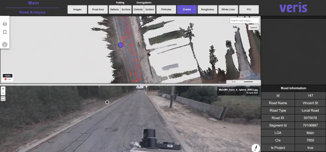
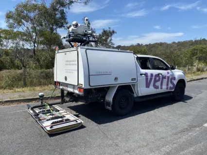
Veris uses vehicle-mounted mobile mapping to capture high-resolution imagery and detailed 3D point clouds along roads. This approach enables efficient capture over large distances while reducing the need for personnel to work within active traffic environments.
The resulting datasets support road condition assessments, surface crack detection, dilapidation surveys and asset mapping. They also provide a visual and spatial record that teams can revisit as planning requirements evolve.
For clients, this creates a stronger starting point for assessing conditions and defining where further investigation or maintenance may be needed.
Investigate what the surface cannot explain
Visible damage can raise questions that surface inspection alone cannot answer. Why is cracking concentrated in one section? Are conditions beneath the pavement contributing to the problem? What additional evidence would help engineers assess an appropriate response?
Veris can combine mobile mapping with 3D Ground Penetrating Radar (GPR) and supporting surveys to investigate both surface and subsurface conditions.
On a pavement analysis project in Adelaide, this approach helped investigate the potential causes of surface cracking. Analysis identified associations between cracking, thinner road base and higher relative moisture levels, providing evidence to inform the client’s future management of the road surface.
Understanding these relationships helps teams approach maintenance with a more complete view of the asset.
Put the information where people can use it
Collecting detailed data is only part of the process. Its practical value depends on whether the people responsible for the network can find, understand and use it.
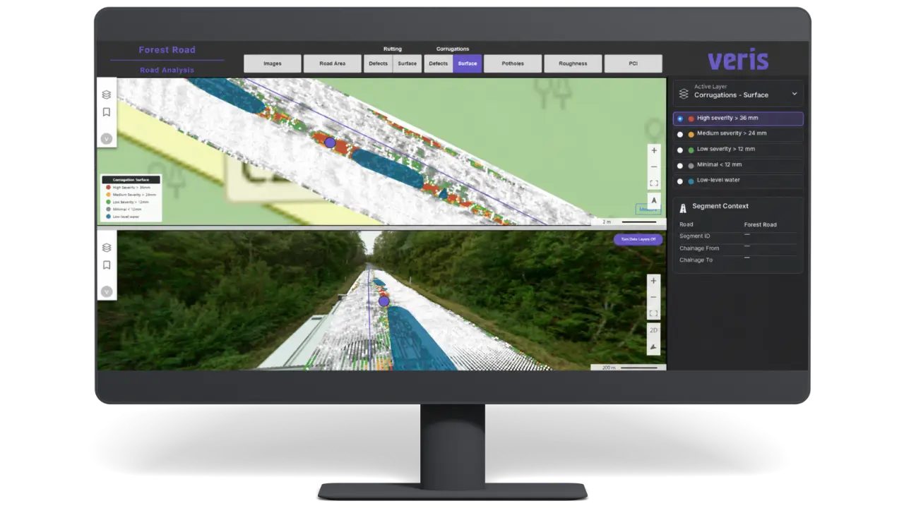
Veris’ RoadSiDe connects road condition information with a secure, cloud-based platform. Users can access maps and panoramic imagery, explore customisable dashboards and query information without proprietary software. Data export supports integration with existing asset management systems.
The solution brings surface capture and subsurface insights together to support condition assessment, targeted maintenance and road network planning.
This connection between physical capture and digital access helps bridge the gap between collecting a dataset and using it in day-to-day decisions. Clients reviewing a section of the network need information they can interrogate and discuss with colleagues, engineers and delivery partners.
A connected approach at network scale
Veris has demonstrated this approach across extensive road corridors.
For a major transmission infrastructure project, the team captured 1,000 kilometres of road data in under two weeks with staged delivery through RoadSiDe in the following weeks.
The work included sealed and unsealed roads, cracking and rutting reports, GIS datasets and road width analysis. Stakeholders could review captured conditions remotely in 2D and 3D, helping the client identify previously unknown areas of concern and support route planning.
While the project focused on construction route assessment, it demonstrates the practical connection between capturing an extensive network, analysing its characteristics and making the findings accessible.
Build the evidence behind road investment
For councils and road authorities, maintenance decisions involve competing needs, limited budgets and expectations for visible improvements.
Reliable condition information provides a foundation for those decisions. It helps teams explain priorities, identify where more investigation is warranted and plan works with greater confidence.
By combining reality capture, road condition analysis and RoadSiDe, Veris helps connect the physical road network with the information needed to manage it.
Whether the immediate challenge is understanding surface deterioration, investigating subsurface conditions or making existing road data easier to access, the starting point is the same: a clearer picture of the asset.