

Victorian Women’s Health Atlas
Produced by Women's Health Victoria, the Victorian Women's Health Atlas is a free, interactive platform that shares health and social wellbeing data across every local government area in Victoria. It supports evidence-based planning, advocacy and policy by bringing together more than 90 indicators across key health and socioeconomic categories - many of which aren't available anywhere else.
Challenge
Behind the Women's Health Atlas project was the former Spatial Vision team, now Veris, who designed and built the app in 2015, a free, interactive platform that maps the health and wellbeing indicators across Victoria. Ten years later, the Atlas was still a trusted resource for health planners, policymakers, researchers and community organisations, however the design looked dated and its open-source components were so out of date that they risked stopping working in modern browsers. The architecture made it hard to add features or fix bugs, so changes WHV wanted could not be made. The charting library was limited and no longer maintained. The platform also had no mobile support, and mobile users only saw a screen saying it was unavailable. On top of this, the data was loaded statically. That worked with a few dozen datasets in 2015, but with more than 700 datasets it had become slow, heavy for browsers and partly manual to update.
Solution
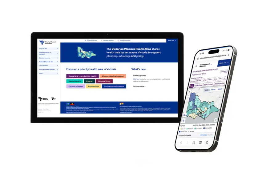
WHV went back to Veris to modernise the platform, and rebuilt it from the ground up using its GIS and application development expertise. The work was first scoped as a technology-only upgrade. Veris went beyond the brief and proposed a full UX redesign, bringing in its UX specialist to simplify navigation, strengthen the information hierarchy and create a cleaner interface in line with WHV’s updated branding. The front end was rebuilt in Angular, and the charting was fully redeveloped on a new, maintained library. Veris also re-architected the data layer so all 700+ datasets now load on demand from a live database, removing the need for manual refreshes. Other back-end work included upgrading the reporting engine, modernising the map services, and adding a semi-automated data upload facility so WHV can update datasets on its own. Static information pages were moved into WHV’s content management system, so WHV can edit them without a developer. Veris also delivered a fully mobile-responsive experience for maps, charts and tables.
Outcomes
The 2026 release of the Atlas is faster, always up to date and scalable. It is simpler to navigate, easier to read, built with accessibility in mind and has seen a doubling of traffic since the release. Changes include a cleaner homepage, better page structure for assistive tools, and mobile-friendly maps, charts and tables that make the data available on any device. WHV now has more control over the platform because it can update data and content without developer help. The modern foundation also removes the risk of the platform becoming unsupported and gives it room to grow. Continuing an 11-year partnership in which Veris has supported the Atlas, from the original build through to regular data updates, enhancements and staff mentoring. WHV also plans to bring the redesigned Atlas into the geography curriculum, and its modern design and mobile access should make it easier for teachers and students to adopt.