Geospatial intelligence and Machine Learning
The Challenge
The study area supported high value agriculture, including an estimated 90% of Australia’s asparagus production.
Ground inspections to inform maintenance intervention are labour intensive and limit the ability to take snapshots at any points in time.
Vegetation overgrowth blocks channels and drains, causing
- Risk of flooding
- Labour-intensive ground inspections
- Loss of land productivity
- Landowners to be at financial risk.
Our Solution
Veris were responsible for the following service delivery:
Determine vegetation classes that allow drain condition to be accurately mapped and monitored.
- Remotely map drains to these classes to target ground-truthing efforts and maintenance
- Improve transparency and evidence-based decision-making through visualised condition trends and prioritised intervention maps
- Support short-term maintenance program modification, short term intervention and long-term renewal planning.
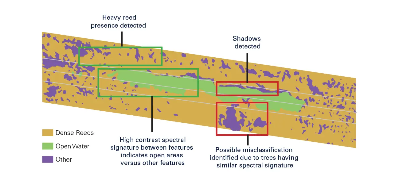
Aerial imagery was used to tell a story:
- Where is vegetation overgrowth occurring?
- How dense is the vegetation?
- What type of vegetation is it?
- Where are the areas of vulnerability?
Research method:
- Obtain imagery and Digital Height Model (DHM)
- Train sample data to detect patterns in imagery and DHM
- Classify vegetation cover
- Score vegetation blockage severity
- Use machine learning to automatically detect and classify vegetation and blockage severity across full dataset
- Visualise outputs on map
Project outputs:
- Vulnerability and performance determined at desktop level.
- Analysis repeatable with every imagery update.
- Change monitored over time.
- Evidence-based.
Outcomes
- Data outputs can be used to inform infrastructure maintenance planning
- Melbourne Water will apply machine learning and geospatial intelligence across all channels, drains and wetlands.
- Ground-truthing and maintenance efforts are more targeted and cost-efficient.
- Landholders are better protected from flood.