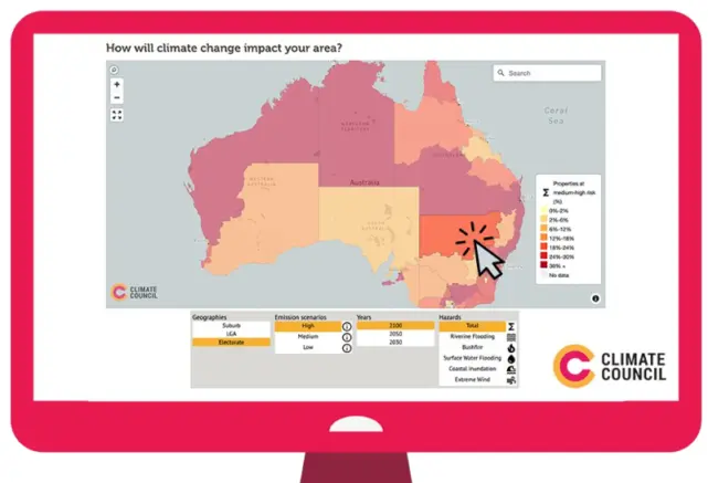
Climate Risk Map
The former Spatial Vision team now operating in Veris, developed an interactive map of Australia for the Climate Council that represents the vulnerability of any address to the effects extreme weather over different timeframes and emission scenarios. The underlying data was supplied by Climate Valuation.
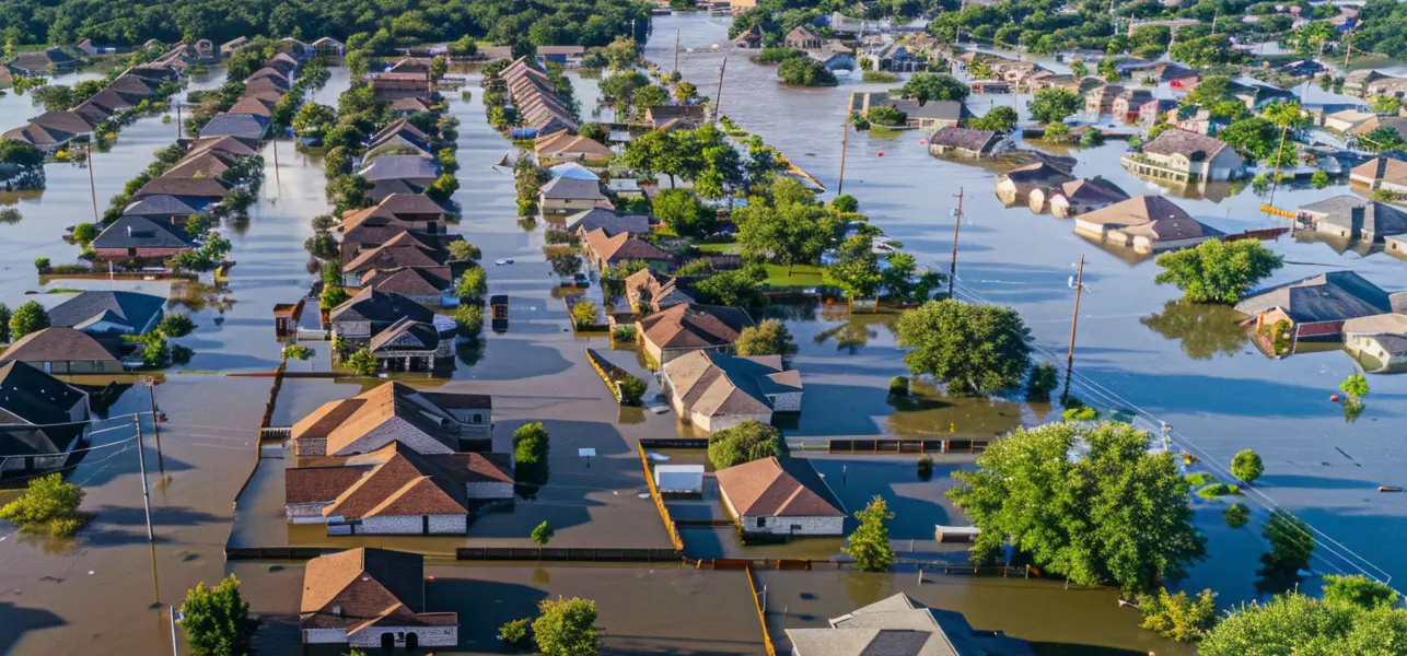
In recent years many thousands of Australians have experienced the heartache, havoc and homelessness caused by bushfires and flooding. Exposure to such natural disasters has become increasingly frequent and severe. Climate change is the increasing frequency and impact of extreme weather events.
Decisions and actions over the term of the new Australian Government will directly influence the future impacts of climate change for generations to come. As the threat to at risk residential areas rises, so too will insurance premiums – potentially to the point where owners can no longer afford home insurance, or the risk of their location is deemed so high as to be classified uninsurable.
The former Spatial Vision team worked with the Climate Council to develop a user friendly web application for the general public as part of its Uninsurable Nation Report, designed to push the compelling financial argument for urgent and significant action to reduce emissions and achieve net zero.
Users can enter their suburb, local government area or electorate to determine the risk of fires, floods and extreme wind, based on low, medium and high emission scenarios and specified timelines (2030, 2050 and 2100).
The Challenge
Climate change is driven by the burning of coal, oil and gas supercharging our weather systems. The real effects of climate change are already upon Australia, as evidenced by recent mass evacuations and destruction experienced by many thousands of Australians causing heartache, havoc and homelessness. Exposure to such natural disasters has become increasingly frequent and severe.
It is predicted these outcomes will escalate considerably unless governments ramp up their efforts to reduce emissions.
The Solution
Spatial Vision partnered with the Climate Council to visualise the 14 million Australian residences in relation to their risk to extreme weather and effects of climate change.
Spatial Vision developed a cutting-edge Climate Risk Map able to be used by any Australian family to determine their vulnerability. The solution was built using Mapbox GL JS in conjunction with vector tiles to ensure a highly responsive application.
Mapbox GL JS enabled us to customise the user experience and tools of the application so that it was easy to use on both desktop and mobile devices as an embedded map on a web page. The key challenge with any web mapping application is to ensure it remains functional when embedded. Mapbox GL JS helps to ensure this is possible.
Mapbox offers free tiers for map loads and vector tile views reducing the total cost of the project. The application includes a template that users can complete to email the local politician within their electorate.
The Benefits
The scope of work undertaken assisted the Climate Council in several ways:
- Injecting climate change into the media cycle of a federal election campaign
- Effectively communicating the impacts of climate change, particularly extreme weather events such as mega floods and bushfires and their devastating impacts
- Attracting positive feedback from town planners, local government staff, members of parliament, school children, academics and students
- Providing a user-friendly mechanism to facilitate ground-up advocacy
- Communicated, by including multiple emission scenarios for the future, how dangerous business as usual is – and how much better things will be if greenhouse gas emissions are reduced as quickly as possible
- Providing an advocacy mechanism to influence best practice policy and resourcing.