Custom Mapping Solutions Across Australia
From topographic map books to digital wall maps and enterprise-level mapping products, at Veris we create customised solutions that make complex spatial data easy to understand and apply. Whether in print or digital format, our maps are trusted by government agencies, emergency services, and businesses across Australia.
Drawing on authoritative government resources, we deliver clear, accurate, and user-focused maps across a range of platforms – including desktop, mobile apps, and web-based environments. Our extensive experience means we continuously adapt our map products to meet the evolving needs of individuals and businesses, both now and in the future.
Our Mapping Product Range
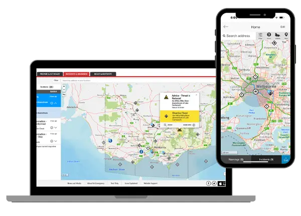
MAPSCAPE
The latest, authoritative topographic mapping with multi-level scaling. MAPSCAPE can be incorporated into desktop platforms as a seamless base map or hosted in your own environment like VicEmergency Web and mobile. Try it out now.
- MAPSCAPE Raster: Comprises four state-wide tile sets of topographic map images with 13 scale levels.
- MAPSCAPE Vector: Comprises one state-wide tile set of topographic map vector tiles with multi-level scaling.
- MAPSCAPE Hosted: Custom hosting arrangement with integration assistance from our team of specialists.
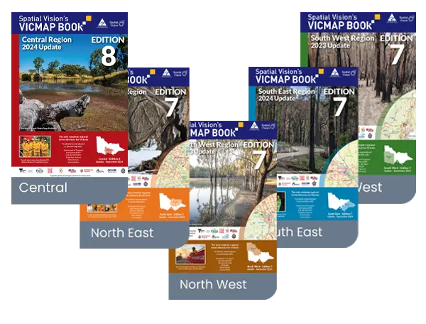
Vicmap Books
Printed maps containing the latest, authoritative topographic mapping used by Emergency Services across Victoria.
Find a Stockist
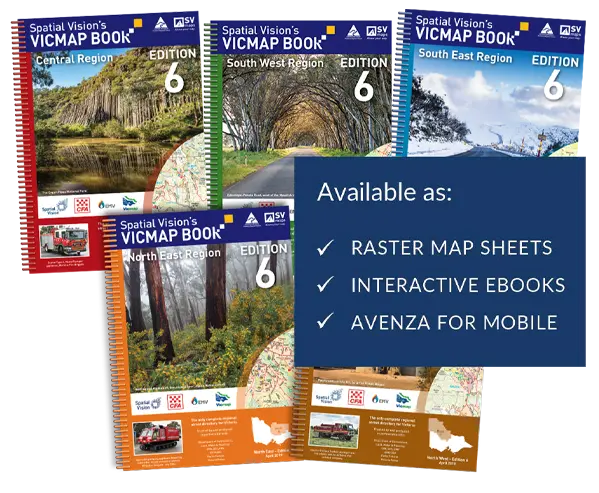
Digital Vicmap Books
Our digital VicMap Book series includes large-scale maps of cities and towns with over 80 input layers sourced from government agencies and private organisations. Available in a variety of file formats, including print-on-demand PDF eBook.
- Digital VicMap Book Images: Digital raster map sheets from our VicMap Book series with state-wide coverage including five Victorian regions.
- Digital VicMap Book eBook: Interactive digital eBook with search and print-on-demand capabilities. Accessible online and offline on any device.
- Digital VicMap Book Avenza: Portable mobile version accessible via the Avenza Maps app. Utilises GPS – no mobile reception or internet required.

Custom Maps & Wall Maps
Custom maps such as sheet maps, wall maps, atlases, or interactive maps for digital and web applications.
Contact us for all your enterprise-level mapping requirements.