Geraldton Virtual Port
Geraldton Port facilitates the export of grain, minerals and livestock, and imports fuel, minerals, fertiliser, and bulk cargo while welcoming cruise ships, oil rig tenders and other expedition craft. The Mid West Ports Authority (MWPA), who is responsible for the safe, secure, efficient and environmentally friendly operation of Geraldton Port, is developing a ‘Virtual Port’.
The Digital Twin will enable more effective use of data for Geraldton Port to understand place-based policy and planning issues, test potential interventions, improved decision-making and deliver more sustainable planning and development.
The Challenge
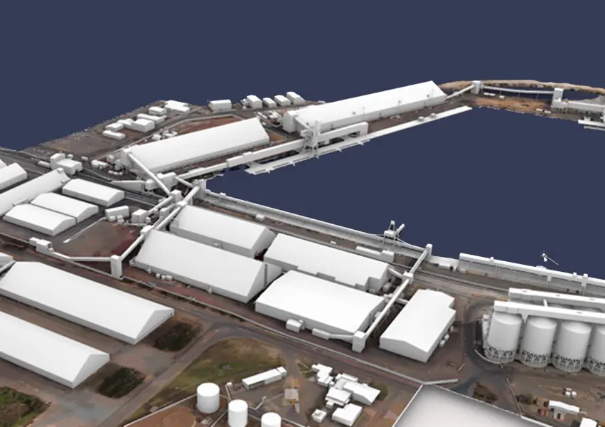
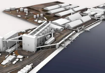
Veris was engaged to capture and develop a high quality, high accuracy 3D reality model of the Geraldton Port precinct and surrounds. The spatial data will become a major component and data source for the Virtual Port in the future.
Our Solution
We provided an end-to-end solution for our client, combining our expertise in Unmanned Aerial Vehicle (UAV) data capture with our advanced capabilities in data processing and 3D modelling.
Deploying multiple UAV technologies for best results
With approximately 83 hectares of land within the Geraldton Port, it was necessary to develop a unique solution for data capture that combined the efficiency of large-scale aerial mapping with the requirement for high accuracy mapping of buildings and structures within the port precinct.
Windy conditions in the region, and the potential for impact on local communities when flying UAVs near residential housing were additional complexities that needed to be managed.
To meet the needs of coverage and accuracy, we deployed a combination of UAV technologies to capture vertical and oblique imagery. The Quantum Trinity fixed-wing UAV was deployed to perform aerial mapping of the wider area and surrounds. The Matrice 300 RTK UAV was then used for a higher level of accuracy for photogrammetry of buildings and structures in the port precinct.
Flight paths and scheduling were adjusted to manage the windy conditions and ensure community impacts were minimised.
Terrestrial Laser Scanning
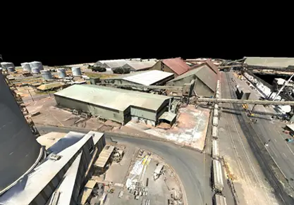
To supplement the UAV surveys, terrestrial laser scanning was also used to scan selected plant and equipment such as conveyors and provide coverage for areas that could not be captured by UAV.
3D reality models
Following on from the data capture, our Digital & Spatial team processed the data to provide a suite of 3D spatial data deliverables to including:
- Point Cloud
- 3D reality mesh
- 3D model to level of detail (LOD) 200.
Outcomes
The 3D spatial data deliverables have already been integrated with the Geraldton Port GIS Portal which is widely shared by stakeholders within MWPA for enhanced visualisation and decision making.
In addition, the 3D data formed the basis of a recent “wind effect” study allowing the Port operational team to analyse the effect of existing structures on channelling the wind and its impact on the efficiency of port operations and the community.
In the future, the high-quality high-accuracy 3D models of the Geraldton Port precinct and surrounds will form a major component of the ‘Virtual Port’ - a Digital Twin being developed by the MWPA.