Murray Irrigation Foundational Asset Condition Assessment Project (FACAP)
In 2025, Murray Irrigation Limited (MIL) launched its most ambitious infrastructure initiative to date: the Foundational Asset Condition Assessment Project (FACAP). This transformative project aimed to assess the condition of MIL’s extensive irrigation network, comprising over 4,000 kilometres of earthen channels and drains, and more than 3,500 structures such as bridges and culverts using cutting-edge aerial and underwater survey technologies. FACAP is a cornerstone of Murray Irrigation Limited’s broader Asset Management Strategy, designed to ensure the long-term sustainability and efficiency of its $1 billion asset base.
The Challenge
Murray Irrigation Limited faced several significant challenges in managing its vast and aging infrastructure:
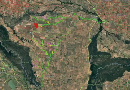
- Scale and Complexity: The irrigation network spans a massive area across the southern Riverina, servicing over 2,100 landholdings. Traditional inspection methods were labour-intensive, inconsistent, and time-consuming.
- Data Gaps: Prior to FACAP, Murray Irrigation Limited lacked a comprehensive, high-resolution dataset of its entire asset base. This made it difficult to plan maintenance, forecast costs, and prioritise investments effectively.
- Operational Disruption: Conventional inspection techniques often required draining channels, disrupting water delivery and impacting agricultural operations.
- Safety and Accessibility: Many assets were located in remote or difficult-to-access areas, posing safety risks and logistical hurdles for field crews.
The Solution
A technology-driven approach was adopted to overcome these challenges. The solution integrated multiple advanced surveying techniques to ensure comprehensive data collection with minimal disruption:
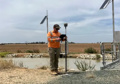
- Aerial Photogrammetry: High-resolution imagery captured using modified aircraft, achieving 1.8 cm GSD
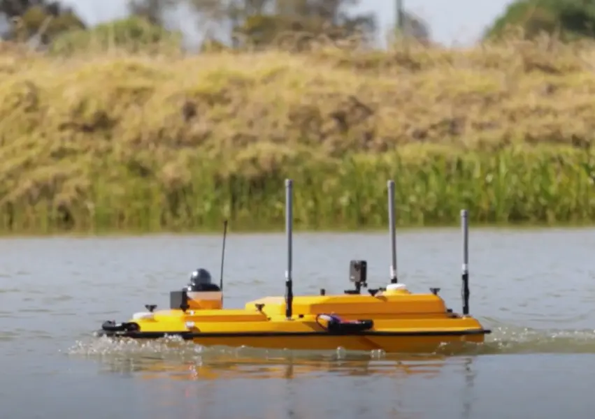
- Bathymetric Surveys: USVs equipped with sonar and GPS mapped underwater assets safely and efficiently
- Integrated Data Analysis: All data was consolidated into a digital twin for defect detection and planning
Veris' Role
Veris led the bathymetric survey component, deploying Unmanned Surface Vehicles (USVs) equipped with single-beam echo sounders and GPS. These USVs collected sonar data at high frequency (every 0.2 seconds), enabling the creation of detailed digital terrain models of submerged infrastructure. Veris’ approach ensured safe, efficient data collection without disrupting water delivery operations.
Outcomes
- Complete visibility of the irrigation network through high-resolution data
- Reduced inspection time and operational costs
- No interruptions to water delivery during surveys
- Improved safety through remote data collection
- Informed long-term planning and investment strategies
- Established a new benchmark for water infrastructure assessment in Australia
- Over 20 Terabytes of raw imagery has been processed by Veris.
- Outputs include Orthomosaic imagery, DSM/DTM tiles and Point clouds for all channels in the network.