West Gate Tunnel Project
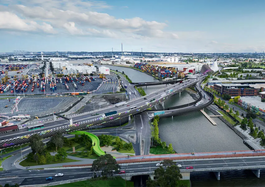
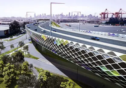
The West Gate Tunnel Project is a major transport infrastructure project for Melbourne, delivering a vital alternative to the West Gate Bridge. The project involves widening the West Gate Freeway, building twin tunnels under Yarraville and a new bridge over the Maribyrnong River that links to an elevated road above Footscray Road.
The challenge
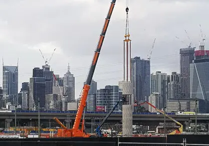
For a city-shaping project of this complexity and scale, which has included some advanced engineering practices, construction contractors CPB Contractors and John Holland (CPBJH JV) required a survey team with the multi-disciplinary capability and capacity to respond to the evolving needs of the project.
Our solution
Our approach to support the works has involved providing our specialist expertise in engineering surveys, 3D data management, subsurface utilities and spatial data capture, combined with leveraging our large footprint in Melbourne to meet the varying resourcing demands of such a large infrastructure project.
Applying our expertise in the 3D data management to the field
Our team have been performing engineering surveys for the bridges and at grade works to link the twin tunnels to existing roads and infrastructure in the East Zones 403 and 404 of the project.
When design updates occurred, it was critical to successfully manage the data to ensure the accuracy of works on site. Our team worked closely with the engineers on the project to establish a process and strong lines of communication to ensure that the survey set-out files agreed with the latest IFC (Issued For Construction) drawings before carrying out our works on site, utilising our expertise in the 3D data environment.
Subsurface - delivering greater certainty and visibility
To deliver greater certainty around subsurface utiltities, we performed data capture in the field of a multitude and complex mix of underground services. After completing field pick-ups and modelling the data, this was then provided to the client for inclusion and checking against a GIS database, enabling visualisation and clash detection with proposed structures and plant operations.
Deploying mobile laser scanning for clearance analysis
With construction equipment and large materials such as concrete segments, headstocks and bridge gantries being transported to site, there was a need perform clearance analysis and route planning for the road network. We recommended and deployed mobile laser scanning (MLS) to facilitate clearance analysis. This involved 3D scanning major roads in the city including Footscray Road and CityLink, as well as over 200km of road to Benalla. MLS was also deployed for other bespoke requirements including pavement analysis, high risk asset inspection and digital terrain modelling. Our approach provided a fast and efficient way to capture detailed data to support decision making and reduce risks.
Managing project peaks and resourcing demands
At its peak, our capacity to support the engineering survey requirements of the project has seen a team of up to 8 surveyors on site. We also had additional resources inducted who could be called upon at peak times and to assist with facilitating night shift works to allow day works to be un-interrupted.
Outcomes
Our approach to working closely with our client to meet their spatial data needs has enabled the following outcomes:
- Avoiding construction re-works and delays through accurate and up-to-date set out surveys
- Greater certainty and visibility of subsurface utilities and clash detection
- Better route planning and reduced risk associated with transporting construction equipment and large materials through clearance analysis
- Project schedule and productivity gains through the ability to flex our survey crews resourcing capacity including night shifts.